- Home
- Essentials
- Mallorca's seven regions, explained
Mallorca's seven regions, explained
Mallorca is small enough to cross in a morning and varied enough to feel like several islands. A limestone range walls off the north-west coast, a flat farming plain fills the middle, long sandy bays open to the north and east, and the south ends in salt pans and low cliffs of golden stone. Knowing the regions is the quickest way to decide where to stay, what each day will look like and how much driving it takes.
Palma and the bay
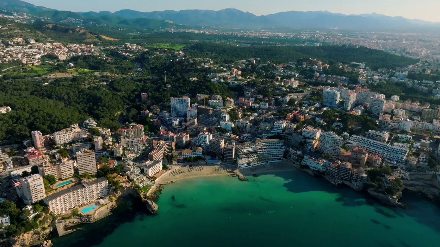
Palma, the capital and the island's only true city, sits at the head of a wide, south-facing bay. The cathedral, La Seu, rises straight from the old sea walls, with the royal palace of the Almudaina beside it. Behind them lies a dense old town of stone lanes, patios and churches. Round Bellver Castle watches the bay from a wooded hill to the west.
The bay curves from the coves around Cala Major to the long, busy sands of Platja de Palma and s'Arenal. Portixol, east along the seafront, still feels like a fishing harbour. Es Baluard, in a Renaissance bastion, and the Fundació Miró Mallorca, at the painter's former studios, hold the city's best-known modern art.
Palma suits anyone who wants galleries, markets and street life all year, 15 minutes from the airport. As the hub of the train and bus networks, it also works well without a car. The trade-off: the bay's beaches are urban and crowded in summer.
The southwest: Andratx and Calvià
West of Palma, the municipality of Calvià holds a run of resorts around small sandy bays, from Palmanova and Magaluf to Santa Ponsa and Peguera, with the marina of Puerto Portals on the edge of the Bay of Palma. The water is sheltered and usually calm in summer.
Further west the mood changes. Andratx is a working inland town with a Wednesday market, and its harbour, Port d'Andratx, lies at the end of a deep, sheltered inlet with villas climbing the slopes. The road ends at Sant Elm, a small resort facing Sa Dragonera, an island natural park reached by boat in season. This is where the Serra de Tramuntana begins.
The southwest suits sailors, lovers of harbour life and sunset watchers, since Sant Elm and Port d'Andratx face west. Port d'Andratx is about 35 minutes from the airport and Sant Elm about 45, outside peak traffic.
Serra de Tramuntana
The mountains run the length of the north-west coast, from Andratx to Cap de Formentor, and hold the island's highest peak, the Puig Major. In 2011 UNESCO listed the range as a World Heritage cultural landscape, not for wilderness but for what people made of it over centuries: olive terraces held by dry-stone walls, water channels, mule tracks, watchtowers and stone villages.
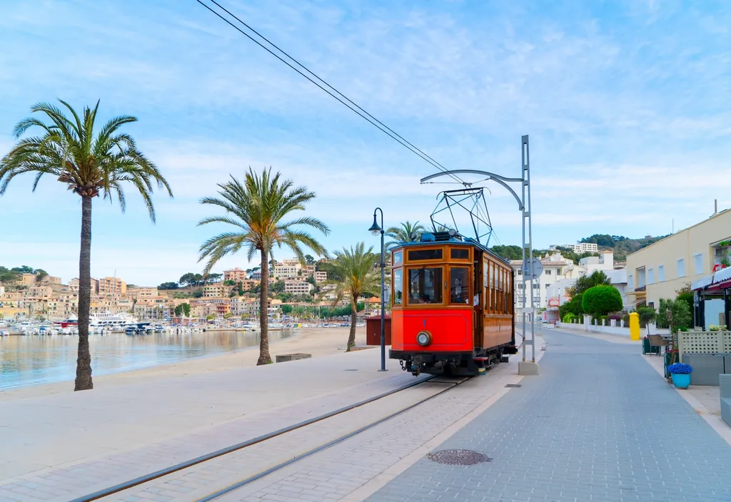
Valldemossa gathers around the Royal Carthusian Monastery, where Chopin and George Sand spent the winter of 1838 to 1839. Deià climbs a hill above a small cove, and the poet Robert Graves is buried in its churchyard. Sóller fills a valley of orange and lemon groves, linked to its port by tram and to Palma by tunnel and by its old railway. Fornalutx, Banyalbufar with its sea terraces, and the sanctuary of Lluc complete the classic route.
The Tramuntana suits walkers on the GR 221, road cyclists and anyone who prefers views to sand. Beaches are few, mostly pebble coves and small harbours such as Port de Sóller. Roads are steep and winding, so distances feel far longer than they look. Sóller is about 35 minutes from the airport through the tunnel; Lluc, deep in the mountains, about 55.
The north: Pollença, Alcúdia and Formentor
At the eastern end of the mountains the land opens onto two wide bays. Pollença is an old stone town a short way inland, where 365 steps climb the Calvari to a small chapel and a Sunday market fills the main square. Port de Pollença sits on a sheltered bay made for swimming and sailing on calm mornings.
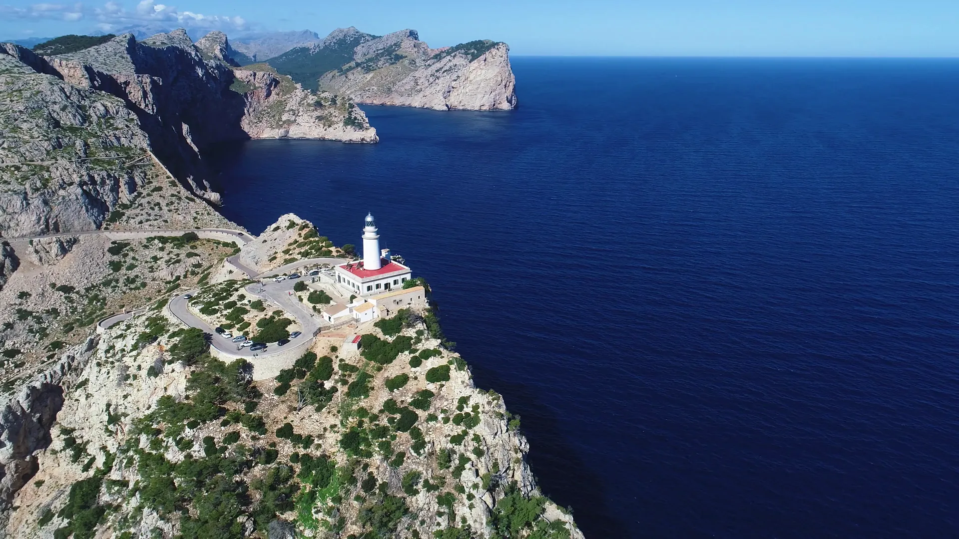
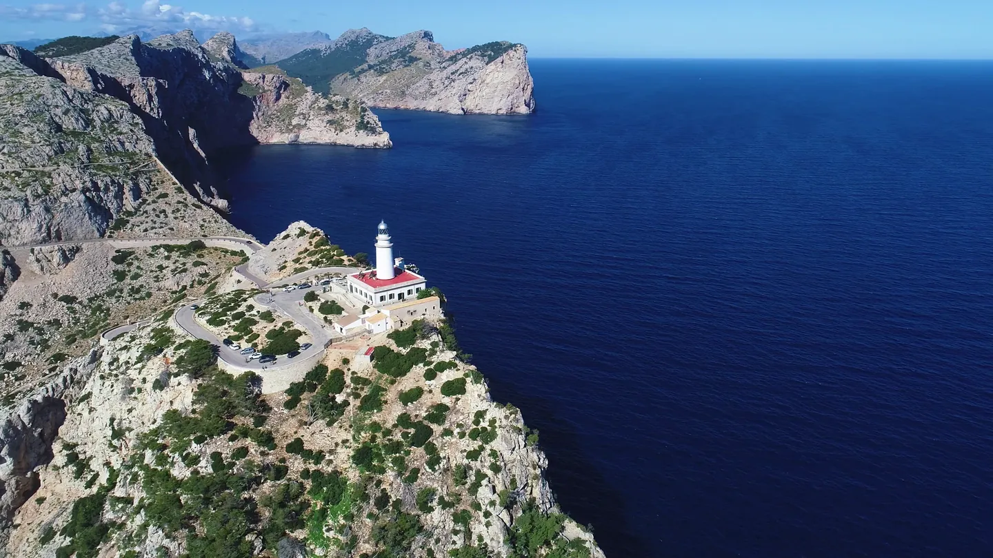
Beyond the port, the Formentor peninsula runs out to sea as a narrow ridge of cliffs, ending at the lighthouse on Cap de Formentor. To the south, Alcúdia keeps its medieval walls and the remains of the Roman town of Pollentia, and its bay has one of the island's longest stretches of shallow, sandy beach. Behind it lies s'Albufera, a wetland natural park loved by birdwatchers.
The north suits families, thanks to shallow water and long promenades, and walkers, cyclists and birdwatchers in spring. Alcúdia is about 45 minutes from the airport and Pollença about 50. Formentor takes around 75, and the last stretch to the lighthouse is restricted for private cars at busy times in summer.
The east: Artà, Capdepera and the Llevant coast
Artà is a hill town crowned by the walled sanctuary of Sant Salvador, with a Tuesday market and, just outside, the Talaiotic settlement of Ses Païsses, built by the island's prehistoric people. North of the town, the Llevant peninsula natural park protects wild, scrub-covered hills and coves reached mostly on foot or by bike.
Capdepera crowns its hill with the walls of a medieval castle, and Cala Ratjada below it (often written Cala Rajada) is a fishing port turned resort, with the beaches of Cala Agulla and Cala Mesquida close by. South from here runs the Llevant coast, with coves, small resorts and harbours from Cala Millor and Porto Cristo to Portocolom, and the market town of Manacor inland.
Mornings belong to this coast, where the sun rises out of the sea. It suits swimmers who prefer coves to big bays, and walkers in the cooler months. Artà is about an hour from the airport and Cala Ratjada about 70 minutes.
The south: Santanyí, Ses Salines and Campos
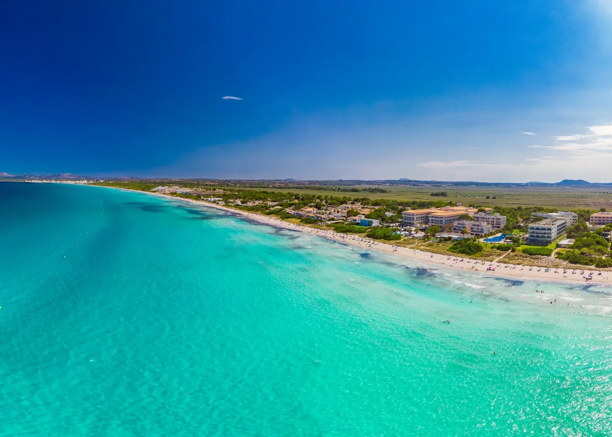
The south is flat, dry and full of light, with stone walls, almond trees and low cliffs above clear water. Santanyí is built of a honey-coloured local sandstone that glows in the evening, and its Wednesday and Saturday markets draw people from across the island. Close by lie the fishing harbour of Cala Figuera, the coves of the Mondragó natural park and the narrow inlet of Caló des Moro.
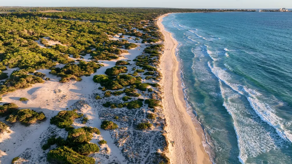
Further west, Es Trenc is a long dune beach with old salt pans behind it, both protected from development. Boats leave Colònia de Sant Jordi for the Cabrera archipelago, a national park, and the lighthouse on Cap de ses Salines marks the island's southernmost point. Inland lies Campos, a farming town.
The south suits swimmers and beach lovers: over sand the water is shallow and turquoise, and the flat lanes are ideal for easy cycling. Shade is scarce and summer heat is real. Santanyí and Colònia de Sant Jordi are both about 45 minutes from the airport, and Cala Figuera about 50.
Es Pla, the centre
Between the mountains and the coasts lies Es Pla, the plain: a patchwork of almond, carob, fig and olive trees, old windmills and stone farmhouses, crossed by quiet lanes. Sineu, once a seat of the medieval kings of Mallorca, keeps a Wednesday market with medieval roots. Inca has a Thursday market and a long shoemaking tradition, and Binissalem is the heart of a wine region with its own denomination of origin.
Es Pla suits people who want a rural house with a pool, cyclists who like empty roads and anyone curious about everyday island life. It has no coast, and that is its strength: from the middle, everything is near. Binissalem is about 25 minutes from the airport and Sineu about 35, and the train from Palma stops at Inca, Sineu and Petra.
It is also the best place to understand distance. Motorways run from Palma towards Inca and Alcúdia, towards Llucmajor and towards Andratx, so most of the island lies within an hour of the airport outside peak traffic. End to end takes around two hours, and mountain roads are slower than their length suggests. Compare places with the drive times tool, and plan one region per day rather than three.
Key points
- Seven regions: Palma and the bay, the southwest, the Tramuntana, the north, the east, the south and Es Pla.
- The Serra de Tramuntana has been a UNESCO cultural landscape since 2011: terraces, dry-stone walls, stone villages.
- For long sandy beaches look to the northern bays and the south; the mountain coast has mostly pebble coves.
- Es Pla has no coast but is the most central base, with market towns, vineyards and almond orchards.
- Most places lie within an hour of the airport, but mountain roads are slow: plan one region per day.
Questions
Which region of Mallorca is best for a first visit?
It depends on what you want from the days. Palma suits a city break with culture and food, the north suits families who want shallow sandy beaches, and the Serra de Tramuntana suits walkers and anyone who loves villages and views. Many first-time visitors split a week between two bases, for example Palma and the north.
How long does it take to drive across Mallorca?
Most places are within an hour of Palma airport outside peak traffic, thanks to the fast roads towards Inca and Alcúdia, Llucmajor and Andratx. The longest drives, from one end of the island to the other, take around two hours. Mountain roads in the Tramuntana are much slower than their distance suggests, so allow extra time there.
Which part of Mallorca is the quietest?
Es Pla, the farming centre, and the far east around Artà are the calmest all year, along with the mountain villages early and late in the day. In summer the busiest areas are the Bay of Palma, the resort coast of Calvià and the best-known coves of the south and east, especially around midday.
Where are Mallorca's best beaches?
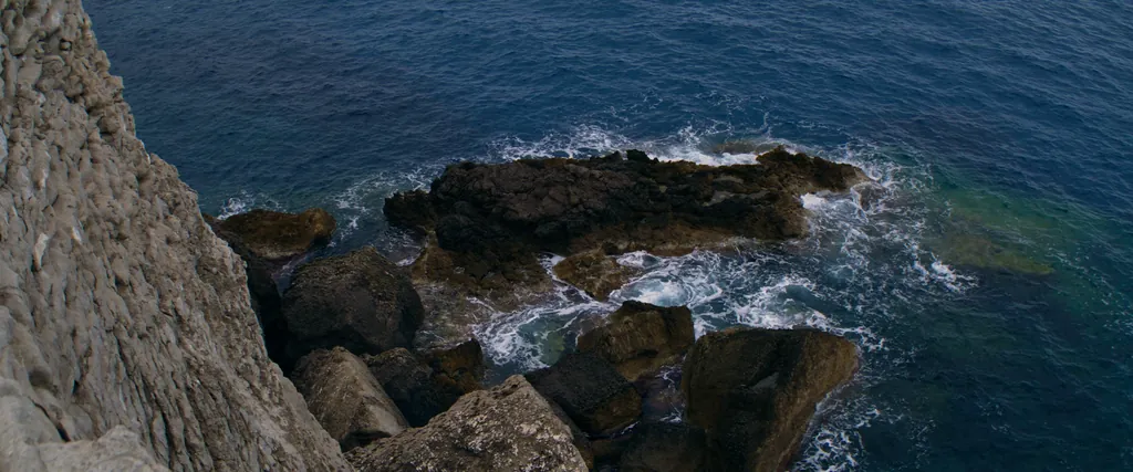
The longest sandy beaches lie in the bays of Alcúdia and Pollença in the north and around Es Trenc in the south. The east and south-east are known for small coves between low cliffs. The Tramuntana coast has few beaches, mostly pebble coves and harbours, but deep, clear water off the rocks.
Official sources
- Consell de Mallorca
- UNESCO World Heritage Centre
- Govern de les Illes Balears
Published 19 October 2026 by the editors of island mallorca. Facts were checked in autumn 2026; rules, timetables and access can change.